|
The solar eclipse of October 3, 1986 by Thorsteinn
Saemundsson
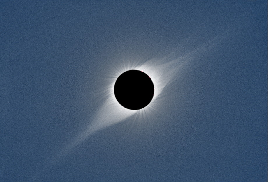
In the forthcoming eclipse of 1986 the track of totality would be much narrower and it was indeed questionable whether the sun would be totally eclipsed. This would be a borderline case and the umbra might possibly miss the earth altogether, but if it did touch the earth this would happen in the area between Iceland and Greenland. The eclipse would take place very close to sunset and as the path would lie over the sea, far from land, the best chance of observing the eclipse would be from an aeroplane. I spoke to my brother, Stefán, who was a professional pilot and discussed the possibility of observing the eclipse from his private plane which was a twin engined Cessna 310. As this type of plane is not pressurised we would have to carry oxygen equipment to get above the highest clouds. However, early in 1986 Stefán, in company with others, bought a small jet aircraft, a Cessna Citation II. We then started planning an eclipse flight with this more capable plane. Because of the cost involved we would have to get others to join us in this adventure. The Citation had room for eight passengers in addition to the pilot and copilot. The projected cost was 20000 Icelandic crowns per person ($500 at the rate of exchange at the time). It was soon apparent that others were interested, both in Iceland and abroad. The newspaper Morgunblaðið wanted to send a photographer. So did Icelandic television. An American by the name of John Beattie called me by telephone and ordered seats for himself and three of his compatriots, the couple John and Mary Goodman and a young astronomer, Dr. Glenn Schneider. All belonged to the dedicated fraternity of people who spend most of their spare time and money chasing after solar eclipses. Each of them had seen from nine to thirteen total eclipses in various parts of the world. I had only seen one totality myself (in 1954) but that was enough to make me understand why people strive to see this spectacle which surely has no equal in nature. One must keep in mind that no two eclipses are alike because the solar corona varies greatly in appearance and solar prominences too. Neither phenomenon can be seen with the naked eye unless the sun is totally eclipsed. The year 1986 was a time of sunspot minimum. At such times the corona often extends furthest in the equatorial region of the sun and takes on the appearance of wings, as can seen in this beautiful photograph taken by the Slovakian astronomer Vojtech Ruin in India in 1995:
This picture is strongly reminiscent of the 1954 eclipse, except that prominences were more in evidence at that time.
There are four types of solar eclipses: total eclipses (0.6 per year on average), annular eclipses (0.8 per year), annular/total (hybrid) eclipses (0.1 per year) and partial eclipses (0.8 per year). The designation annular/total or hybrid is used when an eclipse is seen as total along a part of its path and annular elsewhere. The 1986 eclipse was exceptional because it was a borderline case between total and annular. One of the parameters of an eclipse is called gamma (denoted by the Greek letter γ). This is the least distance between the axis of the moon´s shadow and the earth's centre, expressed in earth-radii. If the shadow (umbra) does not touch the earth, gamma is greater than 1. If gamma is close to 1 we get borderline cases. For the 1986 eclipse, the value of gamma was 0.993.
Predictions varied as to the maximum duration
of totality at the optimal place of observation but it seemed likely
that this could be counted in seconds or a fraction of a second. The
shadow cone would touch the earth between Iceland and Greenland
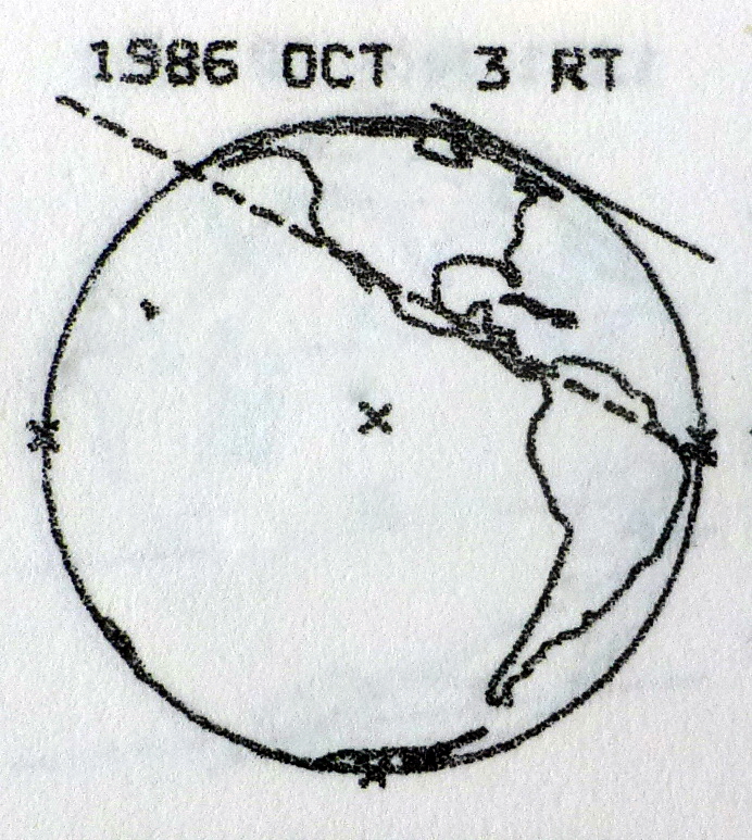
along a curved track from north to south. The accompanying figure
shows the earth as seen from the sun. The solid line just touching the earth
marks the centerline of the eclipse while the broken line
indicates the limit of the region where the sun would be partially
eclipsed. That region covered most of North America.
In my calculations I used my own program,
written in Basic, originally for a pocket computer (Sharp PC-1261).
The program followed a method described in the book "Canon of
Solar Eclipses" by Hermann Mucke and Jean Meeus (1983). The drawing
above is from that book. Meeus is an acknowledged expert in
spherical astronomy and celestial mechanics. I had been
corresponding with him for a number of years and had obtained from him
details of lunar occultations for publication in the Icelandic
University Almanac. When I started working on the 1986 eclipse I
used the eclipse elements (Besselian elements) provided in the Canon
of Mucke and Meeus. I later decided to use the elements published
in the British-American "Astronomical Almanac". These
elements were based
on more recent information on the moon's motion, placing
the moon 0.48 seconds of arc further north at the time of the
eclipse (1/4000 of the
moon's diameter). This correction, though small, shifted the
calculated path of the eclipse by 7 km for a sun elevation of 6.5
degrees and an expected flight level of 40000 feet (12190 m). This
makes clear the importance of accuracy when calculating the
circumstance of this unusual eclipse.
I next decided to correct for the difference between the moon's centre of figure and its centre of mass, something which the Astrononomical Almanac did not do. According to information I received from Meeus, this correction amounted to 0.6 seconds of arc. Taking this into account would move the path westwards by 8 km according to my calculations. Atmospheric refraction had to be considered too. This can usually be neglected in eclipse calculations but in this particular case, with the sun so near the horizon, it would have the effect of bending the shadow cone significantly downwards. I considered this and found that at sea level the refraction would make a sizeable difference, lowering the tip of the shadow by 300 m and shifting its path by 2 km at maximum eclipse. At an altitude of 12 km, however, the lowering would only amount to 20 metres and the effect could be disregarded. According to my calculations the maximum duration of totality would be less than one second and the width of the eclipse track only 10 km. The various corrections mentioned above were of minor importance compared to the effect of observing from a height of 12 km instead of sea level. At 12 km the path was 100 km further to the west. The Astronomical Almanac was using a larger value than I did for the mean diameter of the moon. This gave a longer eclipse duration (3 seconds) and a wider track (37 km).
The September 1986 issue of Sky and Telescope
carried an article by meteorologist Edward Brooks, known for his
interest in eclipses. Brooks had been in touch with Fred Espenak,
astrophysicist at the Goddard Space Flight Center and an expert in
eclipse calculations. In Brooks' article, the predicted time of
maximum eclipse was 19:06, in agreement with my own calculations,
but the path was located 23 km to the west of mine. According to
Espenak the duration of totality would be 3.5 seconds. Brooks
pointed out that by flying
along the path in the same direction as the shadow at 700
miles/hour (1130 km/h) the duration could be increased by 1 2/3
seconds. [Few aircraft cruise at such a speed so even
this was optimistic.] The velocity of the shadow relative to ground
was about 3400 km/h (2100 miles/h). Brooks concluded that a special
effort to see this eclipse would not be worthwhile, but a passenger
jet might possibly be passing this way at the right time. In that
case the passengers would have the privilege of being the only people
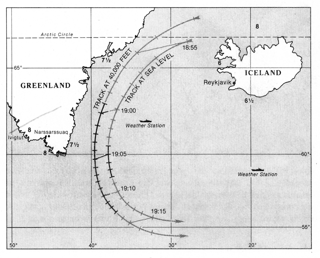
in the world to see totality on October 3rd. A map from Brooks' article is shown below.
Observe the large difference between the path at 40000 feet and that
at sea level. (Click on the small picture to see the full article.)
Having read this article I spoke to Espenak by telephone and received further information from him. Espenak told me that he had used his own Besselian elements and made allowance for a 0.6" difference between the moon's centre of figure and its centre of mass. He also said that he had corrected for refraction. He initially sounded confident of his results but later in the conversation he admitted that it might have been better to use the elements in the Astronomical Almanac. He later sent me new results based on these elements, from which I could deduce that in his calculations, refraction had shifted the track 3 km westwards.
I got in touch with Meeus and with Alan Fiala at the Nautical Almanac Office in Washington, another eclipse expert who was responsible for the eclipse calculations in the Astronomical Almanac. Neither Meeus nor Fiala was prepared to say whether the eclipse would be total. In a borderline case like this one, irregularities at the moon's limb caused by valleys and mountains become important; these can cause deviations of 3-5 arcseconds from the mean limb. Espenak sent me a drawing showing the probable appearance of the limb at the time of the eclipse. After the eclipse I received a comparable drawing from Fiala.
When the American eclipse party arrived in Iceland we got together to discuss plans and compare notes. Glenn Schneider showed us his own calculations which he said were based on Mueller's book (Ivan I. Mueller: Spherical and Practical Astronomy, 1969). Schneider's results were similar to mine but there were minor differences. After lengthy discussions it was decided to rely on my predictions. However, we all realized that there was no certainty that the eclipse would be total and that irregularities at the moon's limb might be decisive.
The following calculations assumed a flight level of 40000 feet (12190 m) and an airspeed of 350 knots (650 km/h). The time taken to climb to cruise altitude is not included but 5 minutes would have been a reasonable estimate.
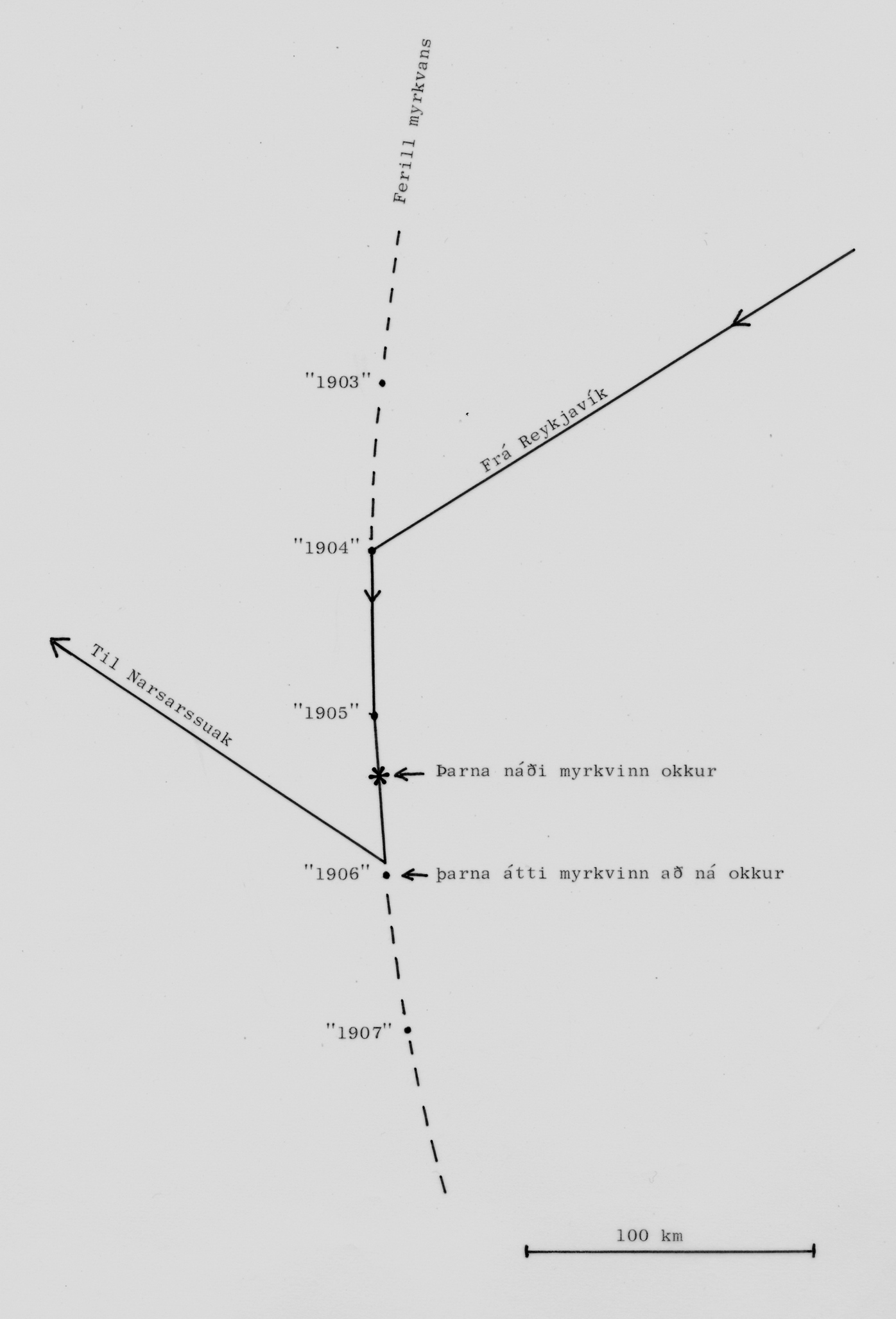
The table shows the position of the shadow at one minute intervals from 19:03 to 19:09 UT. Maximum eclipse was expected at 19:06 and our aim was to be at the right place at that time, 1060 km from Reykjavik. We could have done so by leaving at 17:28 and taken the direct route but it was considered prudent to leave earlier, aim for a point on the eclipse track to the north of position "1906", circle there if necessary and then follow the track and let the shadow overtake us at position "1906". If something should go wrong the shadow would reach us a little earlier or a little later. The possibility of headwind was a further argument for an early takeoff.
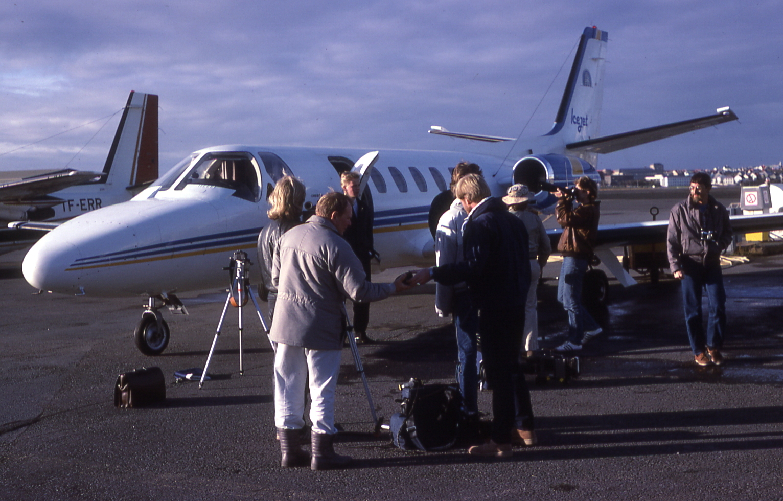
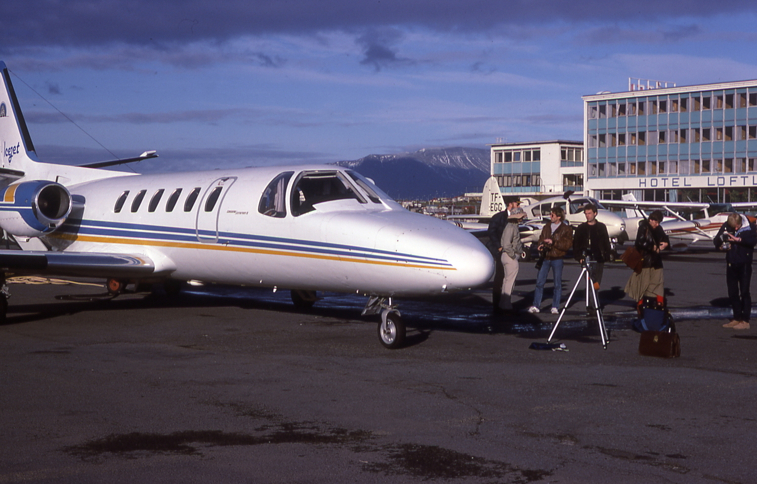
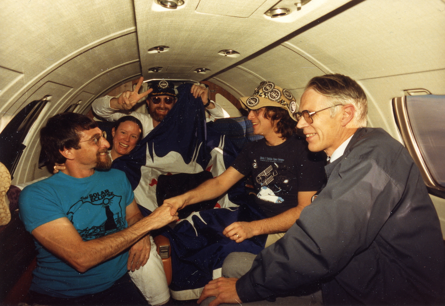
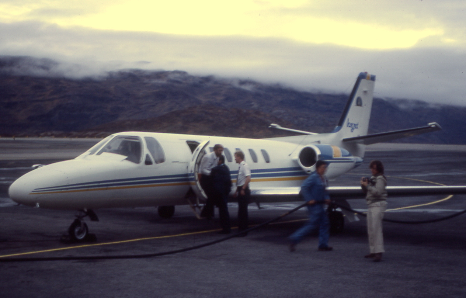
Before the flight, seats had been reserved for newspaper photographer Ragnar Axelsson from Morgunblaðið and TV-photographer Páll Reynisson from Icelandic Television. Copilot was Ágúst Arnbjörnsson. The number of persons on board was therefore nine. As far as is known, these were the only people to see this eclipse. So small a number of people witnessing an eclipse is probably without precedent.
Takeoff was at 16:43. The airplane climbed so steeply that we passengers felt like being in a rocket. After levelling off, the plane circled Reykjavik for a short while. The captain (Stefán) told us that he was adjusting the navigation receivers. These were of two types: Loran C and Omega, predecessors of GPS. Loran was supposed to give location accuracy to within half a kilometer. The Omega system was less accurate but could be reached from any area of the earth, which was not the case with Loran.
After leaving the holding circle, the plane's course was set towards southwest in the direction of the sun. At 18:54 we turned southward into the eclipse path. The shadow caught up with the plane at 19:05:19. That was the time of maximum eclipse according to Glenn Schneider who timed the event with reference to time signals from WWV. The plane was then situated approximately midway between locations "1905" and "1906", about 30 km north of "1906". This divergence from the intended position was caused by the airspeed being lower than planned. Believing that we were ahead of schedule, Stefán had throttled back. The temperature at cruising height was minus 60 degrees C, as predicted by the Icelandic Meteorological Office. Ice was forming on the windows and Páll Reynisson, who was sitting near the door of the aircraft, felt the cold.
In the above sketch, the broken line represents the eclipse track. The solid line with arrows shows the path of the aircraft. The place where the shadow caught up with us is marked with a star.
Some 20 minutes before the eclipse we could detect an unusual hue in the colours of the sky. Just before the eclipse the sky behind us appeared very dark and the clouds below us were strangely gray. Towards the horizon the sky exhibited beautiful colours. The moon's shadow could be seen on the clouds below us. Some of the observers said they could see how the shadow moved past us but I was unable to confirm this myself. The sun appeared higher in the sky than I had anticipated; the altitude of the plane made a noticeable difference in lowering the horizon. Calculations gave a dip of 3.3 degrees.
John Beattie made a tape recording of all that was said on the plane after 18:45 UT and I later received a copy. On the tape one can hear people debating how the eclipse should be categorized, an eclipse that was neither total nor annular. A few minutes of recordings near the time of maximum eclipse can be heard here. →☻ (It may take some time to load the file.)
As the eclipse happened to coincide with the news hour of Icelandic State Broadcasting, I had been asked to describe the eclipse for listeners in Iceland. This I did as soon as the eclipse was over but because of the distance involved we had to use short-wave radio and the connection was not very good.
After the eclipse the plane
turned in a direction to Narsarsuak in
Greenland, 450 km away. We landed there at 20:12 UT and refuelled.
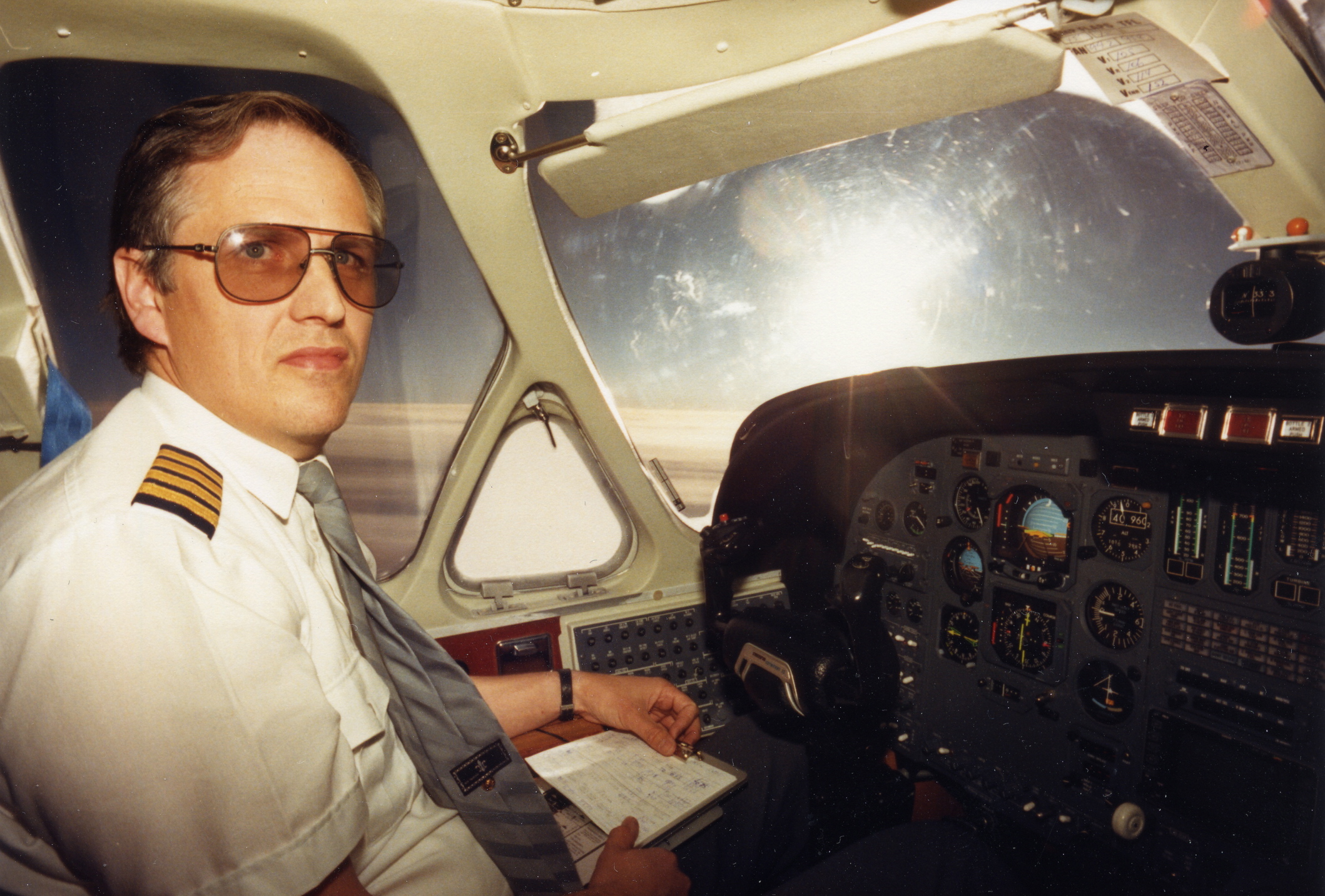
Stefán at the
controls on the way to Narsarsuak. (Photo Th.S.)
Refuelling in Narsarsuak (Photo
Th.S.) We took off from Narsarsuak at 20:50 UT, shortly after sunset there and landed in Reykjavik at 22:58, an hour and a half after dark (astronomical twilight). The distance from Narsarsuak is 1240 km. The total distance flown was 2700 km. An hour after we landed, Páll Reynisson's film was shown on television and the following day the newspaper Morgunblaðið published an account of the flight with pictures taken by Ragnar Axelsson.
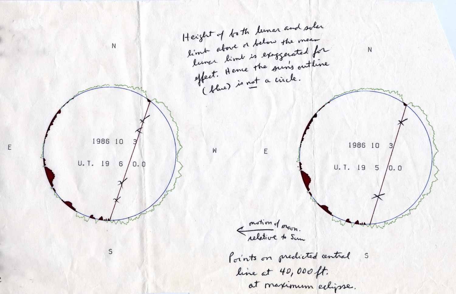
After the eclipse I got in
touch with Alan Fiala. He sent me the
following drawing:
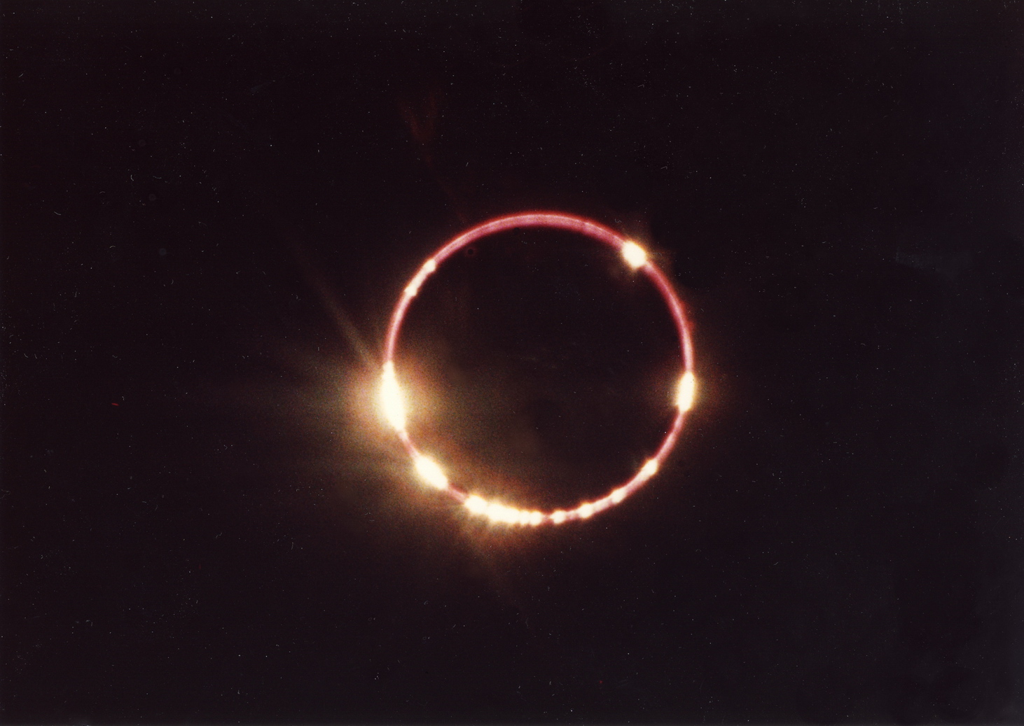
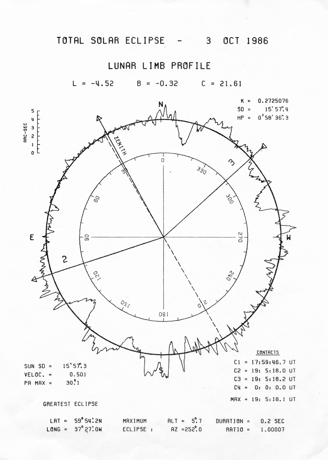
I compared this drawing to one of the same kind that I had obtained from Fred Espenak before the expedition. The drawings were similar but not identical, based as they were on different assumptions. All the same, both gave a pretty good idea of where on the lunar limb the sun might shine through. Unfortunately, I have not kept Espenak's drawing but I have another one which he sent me three months later and this is shown below.
This drawing is calculated for an observer on the ground, about 100 km east of the flight path. When comparing this with Ragnar Axelsson's photograph, allowance must be made for the fact that the orientation is not the same. What is "up" in the photo corresponds to "Zenith" in Espenak's drawing, about 28° to the left of north.
In a letter to Fiala dated 23 November 1986, I expressed my opinion, based on Ragnar Axelsson's picture, that the moon was too high (relative to the sun) as seen from our position, by between half a second to one second of arc. This might indicate that we had been a little to the west of the centre of track. This was indeed the impression we had when we watched the eclipse, that we were stationed too far west. Three possible explanations come to mind and all of these might be involved. First of all there could have been an error in the calculation of the eclipse path in spite of all efforts to ensure accuracy. Secondly, the Loran navigation might not have been as accurate as we assumed. We were not in an ideal spot with regard to Loran ground stations (http://en.wikipedia.org/wiki/Loran-C). Last but not least, we might have been flying at a lower altitude than planned. When altitude is based on air pressure, one has to estimate the pressure at sea level, which in this case was not known with certainty. An error involving the calibration of the altimeter is also conceivable.
It should be added that Espenak's website shows that he has recalculated this eclipse. He now finds a maximum at 19:05:20.6 U.T., almost exactly the time when we observed greatest obscuration.
One might ask whether it is conceivable that the moon was fully eclipsed somewhere in our vicinity and that we just missed totality. This has to be answered in the negative. All available evidence suggests that the eclipse was nowhere total. The photographs support the predictions of Espenak and Fiala as to where the sun's rays would appear on the lunar limb and that the eclipse would not be total. Fiala's drawings show that the calculated appearance of the eclipse from the two reference points, "19:05" and "19:06" is virtually identical.
Our little group naturally wondered whether others might have witnessed this unusual eclipse. When we were approaching the eclipse track, a small single-engined plane was sighted far below us. If this was an eclipse flight, no report to that effect was ever made. The plane was in any case below a layer of high cloud that was fairly continuous. Single-engined planes seldom get permission to fly so far from land unless they are being ferried from one place to another ("positioning flights").
Following the eclipse, Espenak sent me a copy of a letter he had sent to the editor of Sky & Telescope in May 1986, describing his initial calculations for the eclipse. This was never published, probably because it was thought unlikely that anyone would witness the eclipse. In that letter, Espenak predicts that the track of the annular eclipse will be 2.4 km wide at maximum but because of limb irregularities the eclipse will not be total, but a "beaded annular" eclipse and that the solar photosphere will show through at six points on the limb. In his opinion this would be a highly decorative eclipse. To quote: "The true nature of the 3 October 1986 eclipse is a beaded annular far more spectacular than the widely observed eclipse of 30 May 1984".
Shortly after the flight, Glenn Schneider wrote an account of the flight which was published in Sky & Telescope (click on the picture):
Schneider has also placed a longer description on his website:
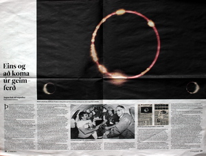
In January 2010, Ragnar Axelsson wrote an article in Morgunblaðið
describing his recollections of the eclipse flight (click on the picture
to see the full article):
April 12, 2015. Last changes: October 7, 2021 |
